
Tour the Gettysburg battlefield > North • Central • South • E. Cavalry Field
The south end of the Gettysburg battlefield was the scene of some of the hardest fighting of the war on the second day of the battle. Longstreet’s attack swept across the Federal flank, turning the Peach Orchard, the Wheatfield, Devils Den and Little Round Top into legendary places in U.S. military history. The assault was stopped – barely – and for the last day of the battle the two sides contested the ground.
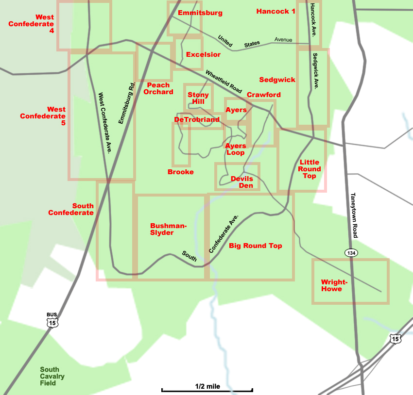
Zoom in on a tour area by choosing from the map above or the menu below:
Ayres Avenue
Ayres Loop
Big Round Top
Brooke Avenue
Bushman-Slyder Farms
Crawford Avenue
Devils Den
DeTrobriand Avenue
Emmitsburg Road
Excelsior Field
Hancock Avenue 1
Little Round Top
Peach Orchard
South Confederate Avenue
Sedgwick Avenue
Stony Hill
West Confederate Avenue 4
West Confederate Avenue 5
Wright-Howe Avenues